Geographyഭൂമിശാസ്ത്രം
Low rainfall, sitting against the Palakkad border
പാലക്കാട് അതിർത്തിയോട് ചേർന്ന് കിടക്കുന്നതിനാൽ മഴ കുറവ്
The real shape of the land · യഥാർത്ഥ ഭൂപ്രകൃതി
Drag to rotate · scroll to zoom
Real elevation data, sampled against the surveyed panchayat boundary · യഥാർത്ഥ ഭൂപ്രകൃതി
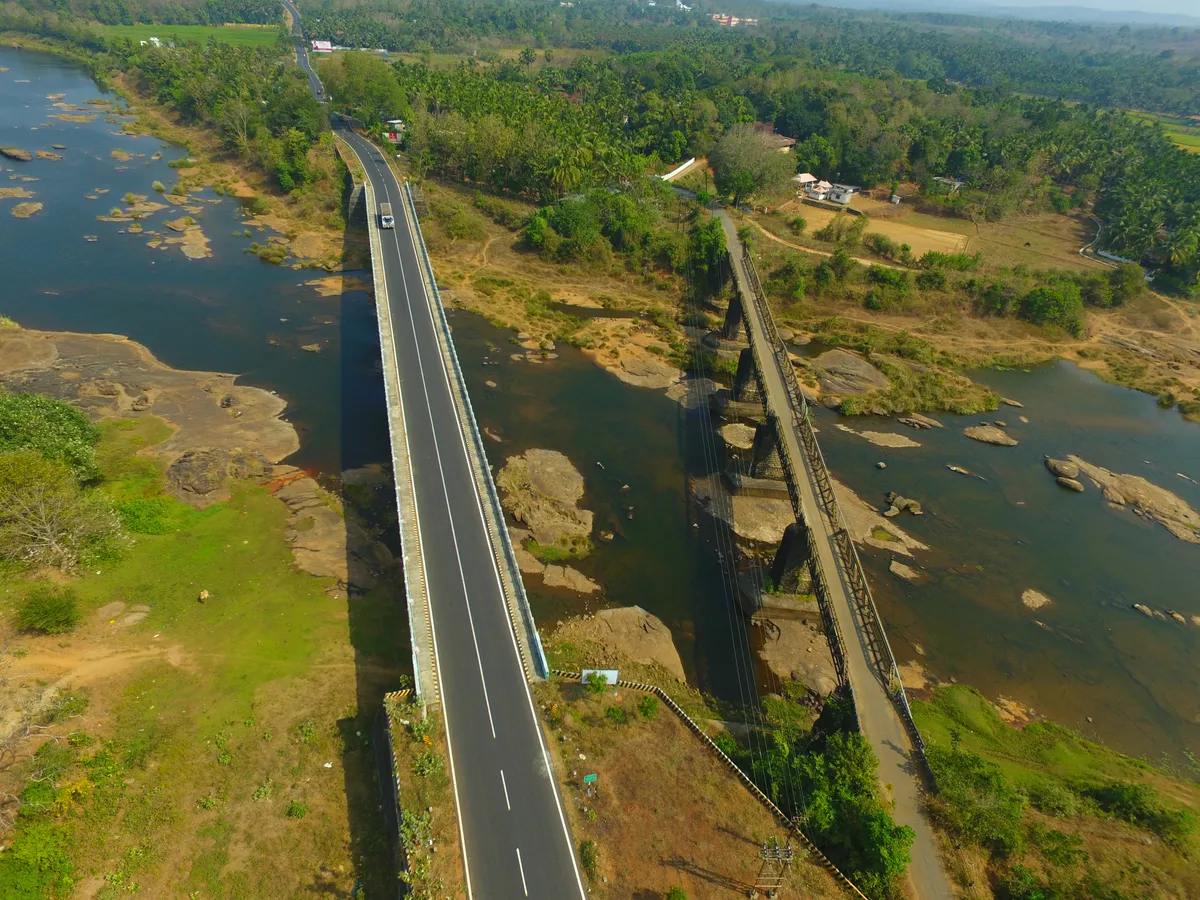
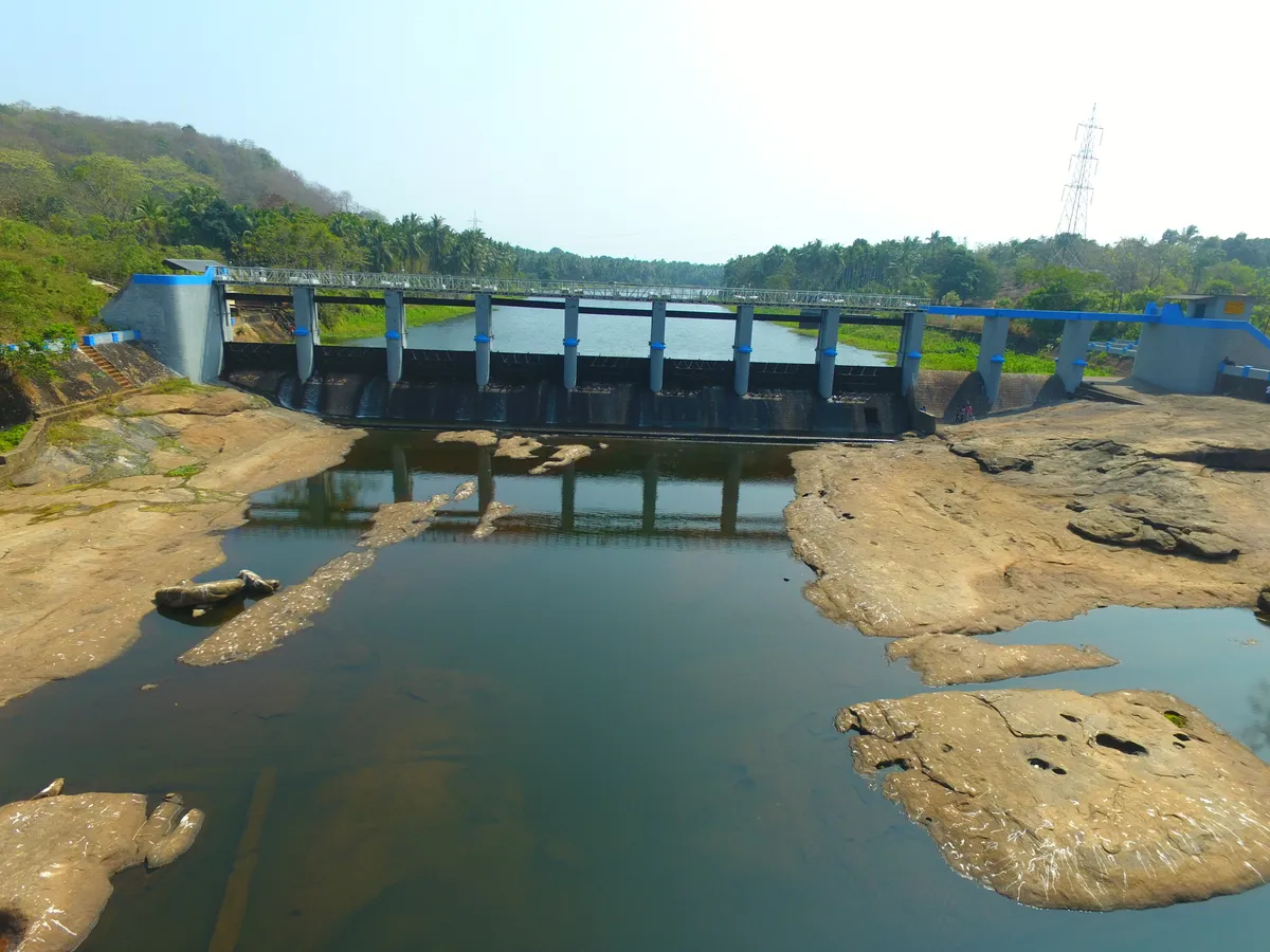
The Gayathripuzha, Pazhayannur's northern boundary · ഗായത്രിപ്പുഴ
0
Area sq km
വിസ്തീർണ്ണം
0
Lowest point
ഏറ്റവും താഴ്ന്ന സ്ഥലം
0
Highest point
ഉയരം
What borders Pazhayannurഅതിരുകൾ
North
Gayathripuzha
ഗായത്രിപ്പുഴ
South
Reserve forest
റിസർവ് വനം
East
Kannambra, Puthukkode
കണ്ണമ്പ്ര, പുതുക്കോട്
West
Chelakkara, Kondazhi
ചേലക്കര, കൊണ്ടാഴി
Land, soil and cultivationഭൂപ്രകൃതി
Villages
Pazhayannur, Vadakkethara, Elanad, Vennur
വില്ലേജുകൾ
Elevation
30 – 494 m ASL
ഉയരം
Soil
Rock, laterite, red and black soil, clay
മണ്ണ്
Plantation
Teak, rubber, coconut, areca nut
തോട്ടങ്ങൾ
Cultivation
Paddy fields, banana, pepper, cashew, jackfruit, mango and vegetables
കൃഷി
Highlands
Forested hills, peacock hills, wildlife and rock formations
മലനിരകൾ
Water for the fieldsജലസേചനം
The Cheerakuzhi Irrigation Project
ചീരക്കുഴി ജലസേചന പദ്ധതി
A masonry weir across the Gayathripuzha — the Bharathapuzha's main tributary — just upstream of the bridge on the Pazhayannur–Thiruvilwamala road, sitting on the boundary between northern Thrissur and southern Palakkad districts.
ഭാരതപ്പുഴയുടെ പ്രധാന പോഷകനദിയായ ഗായത്രിപ്പുഴയ്ക്ക് കുറുകെ, പഴയന്നൂർ-തിരുവില്വാമല റോഡിലെ പാലത്തിന് അപ്സ്ട്രീമായി നിർമ്മിച്ച മേസൺറി തടയണ — തൃശൂർ ജില്ലയുടെ വടക്കും പാലക്കാട് ജില്ലയുടെ തെക്കുമായുള്ള അതിർത്തിയിലാണ് ഇതിന്റെ സ്ഥാനം.
0
Construction begins
നിർമ്മാണം ആരംഭിച്ചു
0
Construction completed
നിർമ്മാണം പൂർത്തിയായി
0
Commissioned
കമ്മീഷൻ ചെയ്തു
Total canal length
50.70 km
മൊത്തം കനാൽ നീളം
Main canal
40.90 km
പ്രധാന കനാൽ
Branch canals
4 · 9.8 km
ശാഖാ കനാലുകൾ
Ayacut (irrigated area)
1,200 ha
ജലസേചന പ്രദേശം
Flow into the canal is regulated through a sluice on the reservoir's left bank; the main canal begins at 36.12 m above sea level. The project mainly serves mundakan (second-crop paddy) cultivation. Water remaining at the end of the canal network is finally released into the Bharathapuzha at Kondayur.
സംഭരണിയുടെ ഇടതുവശത്തുള്ള സ്ലൂയിസ് (മതക്) വഴിയാണ് കനാലിലേക്കുള്ള ജലപ്രവാഹം നിയന്ത്രിക്കുന്നത്. സമുദ്രനിരപ്പിൽ നിന്ന് 36.12 മീറ്റർ ഉയരത്തിലാണ് പ്രധാന കനാൽ ആരംഭിക്കുന്നത്. പ്രധാനമായും മുണ്ടകൻ വിളകൾക്കാണ് ഈ പദ്ധതി ഏറ്റവും കൂടുതൽ പ്രയോജനപ്പെടുന്നത്. കനാലിലെ ബാക്കിയുള്ള ജലം ഒടുവിൽ കൊണ്ടയൂരിൽ വെച്ച് ഭാരതപ്പുഴയിലേക്ക് ഒഴുക്കിവിടുന്നു.
Beneficiary villages · ഗുണഭോക്തൃ വില്ലേജുകൾ
The sole source of irrigation for these 11 villages of Thalappilly Taluk, Thrissur District.
തൃശൂർ ജില്ലയിലെ തലപ്പിള്ളി താലൂക്കിലുള്ള ഈ 11 വില്ലേജുകളിലെ കൃഷിയിടങ്ങളിലേക്കുള്ള ഏക ജലസേചന സ്രോതസ്സാണ് ചീരക്കുഴി പദ്ധതി.
On the mapഭൂപടത്തിൽ
Latitude
10.7387° N
Longitude
76.4231° E
680587 · Thalappilly Taluk, Thrissur District, Kerala